Seljordsvatnet – The Inland Viking Passage
Acerca de esta aventura
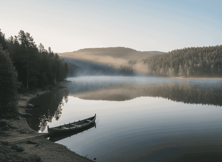
Seljordsvatnet was once a vital inland water route connecting mountain valleys with the coast, forming a crucial link in the network of waterways that Vikings used to penetrate deep into Norway's interior. Before roads, water transport was far more efficient than overland travel through difficult terrain, and Vikings used lakes like this to move goods, animals, and people deep into the interior, connecting coastal trading centers with inland settlements.
The Trail
Seljordsvatnet was once a vital inland water route connecting mountain valleys with the coast, forming a crucial link in the network of waterways that Vikings used to penetrate deep into Norway's interior. Before roads, water transport was far more efficient than overland travel through difficult terrain, and Vikings used lakes like this to move goods, animals, and people deep into the interior, connecting coastal trading centers with inland settlements. The lake's location in Telemark placed it on routes linking the west coast with eastern valleys and eventually connections to Oslo and Sweden. Following the shoreline today, you pass old landing spots identifiable by their gently sloping beaches and protected positions, natural harbors where deeper water close to shore allowed boats to tie up, and quiet bays where boats could be pulled ashore and stored or repaired.
What to Expect
Many of these features are still readable in the landscape for those who know what to look for. The calm water and surrounding hills make it easy to imagine long, narrow boats gliding silently across the lake—the characteristic Viking ship design worked perfectly in sheltered waters like this, allowing rapid movement of people and goods while drawing little water. Archaeological evidence from the region includes boat finds, burial mounds near good landing sites (suggesting settlements of people whose wealth came from controlling water routes), and place names referencing boats, trading, and water transport. The lake is also famous in Norwegian folklore as home to the Seljord serpent, a lake monster reported for centuries, adding mythological dimension to the historical landscape.
Planning Your Visit
The shoreline walk is easy and scenic, following mostly flat terrain with good views across the water. Several access points allow shorter or longer explorations. The lake is approximately 12 km long, so a full circumnavigation would be ambitious, but following sections of shoreline for 2-3 hours offers excellent sense of the water route geography. Best visited during summer for comfortable walking and the ability to appreciate the water conditions that Vikings would have encountered. The town of Seljord at the lake's western end has services and information about the area's history and folklore. This is an excellent destination for families and history enthusiasts wanting to understand Viking-age transportation networks in an accessible, scenic setting.
Never get stuck for words in Norwegian
Someone speaks to you in Norwegian? TalkBuoy listens in real time and suggests exactly what to say back. Your AI companion for travel conversations and language learning.
Divulgación de afiliados Esta página contiene enlaces de afiliados. Podemos ganar una comisión por compras realizadas a través de estos enlaces.
Descubre Telemark con guías locales
¡Evita el estrés de la planificación! Explora miles de tours, actividades y experiencias verificadas. Desde expediciones de auroras boreales hasta cruceros por fiordos - encuentra la aventura perfecta.
Hidden Norway participa en programas de marketing de afiliados, incluyendo GetYourGuide y otros. Esto significa que podemos ganar una comisión cuando reservas tours o realizas compras a través de nuestros enlaces de afiliados. Esto no te cuesta nada adicional y nos ayuda a seguir proporcionando contenido gratuito y de calidad sobre las joyas ocultas de Noruega. Solo recomendamos servicios y experiencias que creemos que mejorarán tu aventura noruega.
Ubicación
Coordenadas GPS
59.4826, 8.6479