Lista – Where Vikings Watched the Open Sea
À propos de cette aventure
The flat headlands of Lista gave Vikings a rare advantage in the Norwegian coastal context: visibility. Unlike most of Norway where mountains crowd the coast limiting sightlines, Lista's low, flat profile meant watchers could see ships approaching far out at sea—often spotting sails hours before they reached shore, providing crucial time to prepare for trade, welcome visitors, or organize defense against raids.
The Trail
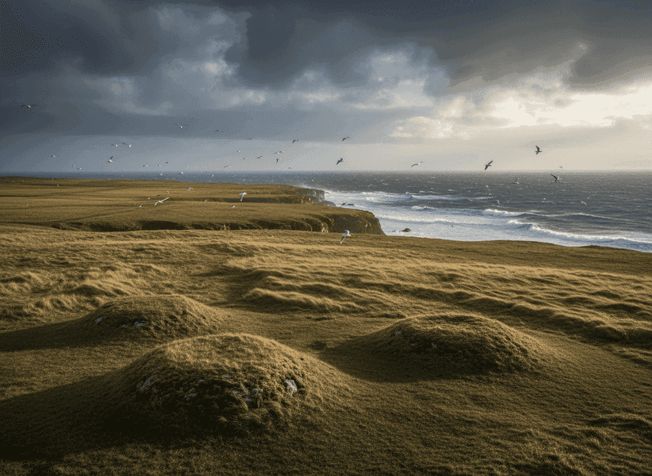
The flat headlands of Lista gave Vikings a rare advantage in the Norwegian coastal context: visibility. Unlike most of Norway where mountains crowd the coast limiting sightlines, Lista's low, flat profile meant watchers could see ships approaching far out at sea—often spotting sails hours before they reached shore, providing crucial time to prepare for trade, welcome visitors, or organize defense against raids. From these low cliffs and open fields, the horizon extends unobstructed in a wide arc covering the North Sea approaches, making this one of Norway's most strategically important coastal monitoring points. This coastal route links old landing places identifiable by their protected positions and beach characteristics, burial mounds concentrated near good anchorages (suggesting wealthy individuals who controlled coastal trade), and natural lookout points—slight elevations that commanded maximum views—used to monitor both trade opportunities and threats from the North Sea.
What to Expect
Lista was a crucial waypoint for ships traveling between Denmark, the British Isles, and northern Norway, making it a hub of Viking-age activity. The archaeological record is rich with finds including boat graves, weapons, jewelry, and evidence of substantial settlements. The wind is constant here, often fierce, shaped by the headland's exposed position jutting into the North Sea, and this constant wind both enabled Viking sailing (reliable winds for navigation) and created harsh living conditions (requiring sturdy buildings and resilient people). The horizon feels endless, particularly on clear days when sea and sky merge in a vast arc—a powerful reminder that the Viking world was as much ocean as land, with seafaring skills determining success or failure.
Planning Your Visit
Walking the coastal route today, you can visit the reconstructed Viking farm at Heimtun, explore burial mound fields, follow coastal paths to old landing sites, and stand at lookout points imagining the anxiety and anticipation of watching unknown sails approach. The flat terrain makes for easy walking suitable for families. Lista Lighthouse adds to the maritime atmosphere, and the area's beaches are among southern Norway's finest. Interpretive signs at key points explain the Viking-age significance. Best visited during summer for comfortable walking, though the area's dramatic weather and seascapes are impressive year-round.
Never get stuck for words in Norwegian
Someone speaks to you in Norwegian? TalkBuoy listens in real time and suggests exactly what to say back. Your AI companion for travel conversations and language learning.
Divulgation d'affiliation Cette page contient des liens d'affiliation. Nous pouvons gagner une commission sur les achats effectués via ces liens.
Découvrez Agder avec des guides locaux
Évitez le stress de la planification ! Parcourez des milliers de visites, activités et expériences vérifiées. Des expéditions d'aurores boréales aux croisières sur les fjords - trouvez l'aventure parfaite.
Hidden Norway participe à des programmes de marketing d'affiliation, y compris GetYourGuide et d'autres. Cela signifie que nous pouvons gagner une commission lorsque vous réservez des visites ou effectuez des achats via nos liens d'affiliation. Cela ne vous coûte rien de plus et nous aide à continuer à fournir du contenu gratuit et de qualité sur les trésors cachés de la Norvège. Nous ne recommandons que des services et des expériences qui, selon nous, amélioreront votre aventure norvégienne.
Emplacement
Coordonnées GPS
58.0954, 6.5617