Hestvika – A Hidden Viking Anchorage
Informazioni su questa avventura
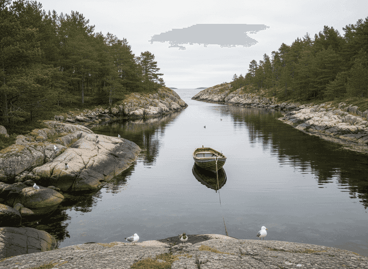
Hestvika is a naturally sheltered bay near Trondheim that would have offered Viking ships protection from storms and open sea winds during the long coastal journeys that connected Norway's scattered settlements. The geography is textbook Viking anchorage: a narrow entrance that limits wave action and provides defensibility (only one approach to watch), calm inner water where ships could anchor or beach safely, nearby freshwater from a small stream for refilling water barrels, and gentle beaches allowing ships to be pulled ashore for repairs or overnight stops.
The Trail
Hestvika is a naturally sheltered bay near Trondheim that would have offered Viking ships protection from storms and open sea winds during the long coastal journeys that connected Norway's scattered settlements. The geography is textbook Viking anchorage: a narrow entrance that limits wave action and provides defensibility (only one approach to watch), calm inner water where ships could anchor or beach safely, nearby freshwater from a small stream for refilling water barrels, and gentle beaches allowing ships to be pulled ashore for repairs or overnight stops. These features made it ideal for short stops during long coastal journeys—Vikings preferred daytime sailing with overnight anchorages rather than sailing in darkness when navigation was difficult and dangers multiplied. Reading the coastline to identify safe anchorages was crucial survival skill passed from experienced sailors to apprentices.
What to Expect
Hestvika represents the kind of local knowledge that made the difference between successful voyage and disaster. Today the place is quiet and little-visited, with only the sound of waves and seabirds breaking the silence, and virtually no modern development to disturb the historical atmosphere. It feels unchanged from how Vikings would have experienced it—the same rocks, the same water patterns, the same shelter from the same winds. This is a perfect example of how Vikings read the coastline and chose safety over convenience, often taking longer routes that hopped between known safe anchorages rather than direct routes across exposed waters.
Planning Your Visit
The bay would have been one point in a mental map of safe stops every experienced coastal sailor carried, allowing them to plan journeys around weather and daylight. Walking the shoreline today, you can easily identify why this spot was chosen—the narrow entrance visible as you approach from the water, the way the headlands block wind from the most common directions, the beach where ships could be pulled up. Archaeological surveys have found evidence of Viking-age activity including fire pits and artifacts suggesting repeated use over centuries. The area is accessible by a short walk from parking, suitable for families. Bring a picnic and spend time contemplating the seamanship skills that allowed Vikings to navigate this coast in open boats. Best visited during calm weather to appreciate the shelter, or during storms to understand why shelter was necessary.
Never get stuck for words in Norwegian
Someone speaks to you in Norwegian? TalkBuoy listens in real time and suggests exactly what to say back. Your AI companion for travel conversations and language learning.
Dichiarazione di affiliazione Questa pagina contiene link di affiliazione. Potremmo guadagnare una commissione dagli acquisti effettuati tramite questi link.
Scopri Trøndelag con guide locali
Evita lo stress della pianificazione! Esplora migliaia di tour, attività ed esperienze verificate. Dalle spedizioni dell'aurora boreale alle crociere sui fiordi - trova l'avventura perfetta.
Hidden Norway partecipa a programmi di marketing di affiliazione, incluso GetYourGuide e altri. Ciò significa che potremmo guadagnare una commissione quando prenoti tour o effettui acquisti tramite i nostri link di affiliazione. Questo non comporta costi aggiuntivi per te e ci aiuta a continuare a fornire contenuti gratuiti e di qualità sui tesori nascosti della Norvegia. Raccomandiamo solo servizi ed esperienze che crediamo miglioreranno la tua avventura norvegese.
Posizione
Coordinate GPS
63.6973, 9.6211