Hardangervidda Eastern Edge – Where Plateau Meets Forest
Om dette eventyret
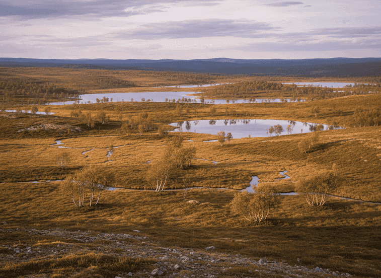
On the eastern edge of Hardangervidda, the high mountain plateau slowly descends into forested valleys, creating a transition zone rich in ecological diversity. This area sees far fewer visitors than the central plateau yet offers the same sense of scale and openness.
The Experience
On the eastern edge of Hardangervidda, the high mountain plateau slowly descends into forested valleys, creating a transition zone rich in ecological diversity. This area sees far fewer visitors than the central plateau yet offers the same sense of scale and openness. Walking here reveals how Norway’s largest mountain plateau connects to inhabited landscapes below. Reindeer migration routes pass through this zone, and tracks are often visible in soft ground. The terrain alternates between open moorland, low alpine vegetation, and scattered birch forest, providing shelter in changing weather.
Planning Your Visit
Small lakes and streams punctuate the route, making it easy to find rest points. The walking is generally gentle, though distances can feel long due to the openness. Summer brings wildflowers and long daylight; autumn adds rich colors and crisp air. Navigation skills are useful as trails can be faint. This route is ideal for hikers wanting the Hardangervidda experience without crowds or extreme exposure.
Never get stuck for words in Norwegian
Someone speaks to you in Norwegian? TalkBuoy listens in real time and suggests exactly what to say back. Your AI companion for travel conversations and language learning.
Informasjon om tilknytning Denne siden inneholder tilknyttede lenker. Vi kan tjene en provisjon fra kjøp gjort gjennom disse lenkene.
Oppdag Vestland / Viken med lokale guider
Slipp planleggingsstresset! Bla gjennom tusenvis av verifiserte turer, aktiviteter og opplevelser. Fra nordlysekspedisjoner til fjordcruise - finn det perfekte eventyret.
Skjulte Norge deltar i tilknyttede markedsføringsprogrammer, inkludert GetYourGuide og andre. Dette betyr at vi kan tjene en provisjon når du bestiller turer eller kjøper gjennom våre tilknyttede lenker. Dette kommer uten ekstra kostnad for deg og hjelper oss med å fortsette å tilby gratis kvalitetsinnhold om Norges skjulte skatter. Vi anbefaler kun tjenester og opplevelser vi tror vil forbedre ditt norske eventyr.
Plassering
GPS-koordinater
60.4301, 7.5802