Inner Junkerdalen – Where the Forest Becomes Alpine
Om dette eventyret
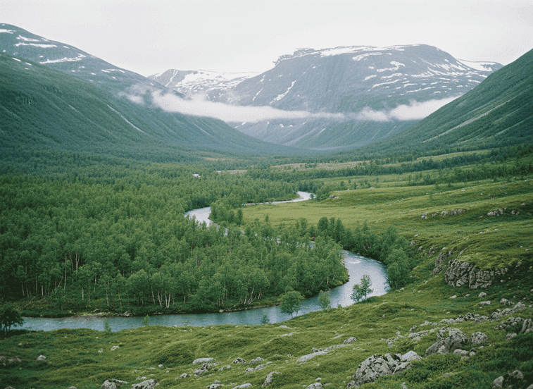
Far inside Junkerdalen National Park, dense birch forest gradually gives way to open mountain terrain as elevation increases and conditions become too harsh for trees, creating a classic transition zone that showcases different ecological communities within a few hours' hiking. The valley penetrates deep into the mountain wilderness of the Nordland-Saltfjellet region, with the inner sections requiring commitment to reach—typically 3-6 hours hiking from road access depending on route.
The Trail
Far inside Junkerdalen National Park, dense birch forest gradually gives way to open mountain terrain as elevation increases and conditions become too harsh for trees, creating a classic transition zone that showcases different ecological communities within a few hours' hiking. The valley penetrates deep into the mountain wilderness of the Nordland-Saltfjellet region, with the inner sections requiring commitment to reach—typically 3-6 hours hiking from road access depending on route. The valley is known among botanists for rare plant species including Arctic alpines, calciphile plants that thrive on the limestone bedrock, and relict species persisting here since the last ice age. The Junkeråga river, remarkably clear with turquoise-tinted water from limestone filtering, cuts through deep green slopes creating a visual and auditory centerpiece. The river's clarity allows you to watch fish from the banks—Arctic char and trout inhabit the cold waters.
What to Expect
The surrounding slopes support lush birch forest in lower elevations, their trunks often covered in lichens indicating clean air, transitioning to willow scrub and finally alpine tundra above tree line. Fewer hikers venture this far compared to the main park entrances and roadside viewpoints, making it ideal for quiet, immersive nature walks where you might not see another person all day. The inner valley offers excellent wilderness camping opportunities with designated areas. Wildlife includes moose, reindeer, wolverine (rarely seen), and various raptors including golden eagles. The valley's north-south orientation creates interesting light conditions with one slope in sun while the other remains shaded.
Planning Your Visit
Navigation requires good map skills as trails may be unmarked in places. Stream crossings can be challenging during high water (June-July). Best season is July-September when snow has cleared and access is easiest. The area is part of a proposed UNESCO World Heritage Site due to its exceptional natural values. Pack all supplies and practice Leave No Trace principles strictly.
Never get stuck for words in Norwegian
Someone speaks to you in Norwegian? TalkBuoy listens in real time and suggests exactly what to say back. Your AI companion for travel conversations and language learning.
Informasjon om tilknytning Denne siden inneholder tilknyttede lenker. Vi kan tjene en provisjon fra kjøp gjort gjennom disse lenkene.
Oppdag Nordland med lokale guider
Slipp planleggingsstresset! Bla gjennom tusenvis av verifiserte turer, aktiviteter og opplevelser. Fra nordlysekspedisjoner til fjordcruise - finn det perfekte eventyret.
Skjulte Norge deltar i tilknyttede markedsføringsprogrammer, inkludert GetYourGuide og andre. Dette betyr at vi kan tjene en provisjon når du bestiller turer eller kjøper gjennom våre tilknyttede lenker. Dette kommer uten ekstra kostnad for deg og hjelper oss med å fortsette å tilby gratis kvalitetsinnhold om Norges skjulte skatter. Vi anbefaler kun tjenester og opplevelser vi tror vil forbedre ditt norske eventyr.
Plassering
GPS-koordinater
66.7815, 15.0982