Ringedalsvatnet Lakeshore – Beneath the Giants
Om dette eventyret
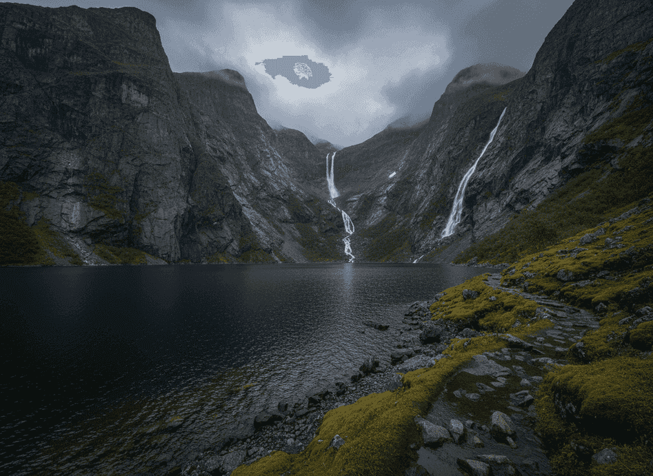
Walking along the shores of Ringedalsvatnet gives a completely different perspective than the famous cliff viewpoints of Trolltunga and Kjerag hundreds of meters above. From lake level, the scale becomes even more dramatic—steep mountains plunge straight into dark water creating vertical walls that disappear into the depths, while the famous rock formations are barely visible as tiny features on the cliffs far overhead.
The Trail
Walking along the shores of Ringedalsvatnet gives a completely different perspective than the famous cliff viewpoints of Trolltunga and Kjerag hundreds of meters above. From lake level, the scale becomes even more dramatic—steep mountains plunge straight into dark water creating vertical walls that disappear into the depths, while the famous rock formations are barely visible as tiny features on the cliffs far overhead. Waterfalls echo in the distance, their sound carrying across the water, and cloud shadows move quickly across the lake's surface creating constantly changing light patterns that shift the mood from bright to moody within minutes. The lake's water is the characteristic turquoise-green of glacial melt, colored by suspended rock flour, and remarkably clear despite the color. The shoreline route follows old maintenance paths once used by workers servicing the hydropower infrastructure that draws water from the lake through massive pipelines to power stations far below.
What to Expect
These paths are now largely reclaimed by moss, grass, and low vegetation, but still provide walkable routes offering intimate access to the shoreline. Stone foundations of old worker buildings appear occasionally, reminders of the intense labor involved in early 20th-century hydropower development in these remote locations. The walking is moderately easy on mostly flat terrain, though some sections require crossing streams or navigating rocky areas. The sense of being at the bottom of this massive mountain amphitheater is profound, with peaks soaring on all sides and the knowledge that thousands of hikers are struggling up the cliffs while you enjoy solitude below. The route offers excellent photography opportunities of the mountains reflected in calm water during still conditions, something impossible from the exposed cliff tops.
Planning Your Visit
Summer is best when trails are dry and daylight extends the exploration time. The area sees a tiny fraction of the visitor numbers compared to Trolltunga, making this an excellent alternative for those wanting dramatic scenery without crowds or extreme hiking. Plan at Visit Norway Hiking.
Never get stuck for words in Norwegian
Someone speaks to you in Norwegian? TalkBuoy listens in real time and suggests exactly what to say back. Your AI companion for travel conversations and language learning.
Informasjon om tilknytning Denne siden inneholder tilknyttede lenker. Vi kan tjene en provisjon fra kjøp gjort gjennom disse lenkene.
Oppdag Vestland med lokale guider
Slipp planleggingsstresset! Bla gjennom tusenvis av verifiserte turer, aktiviteter og opplevelser. Fra nordlysekspedisjoner til fjordcruise - finn det perfekte eventyret.
Skjulte Norge deltar i tilknyttede markedsføringsprogrammer, inkludert GetYourGuide og andre. Dette betyr at vi kan tjene en provisjon når du bestiller turer eller kjøper gjennom våre tilknyttede lenker. Dette kommer uten ekstra kostnad for deg og hjelper oss med å fortsette å tilby gratis kvalitetsinnhold om Norges skjulte skatter. Vi anbefaler kun tjenester og opplevelser vi tror vil forbedre ditt norske eventyr.
Plassering
GPS-koordinater
60.1302, 6.7541