Valle Mountain Route – Viking Passage Between East and West
Om dette eventyret
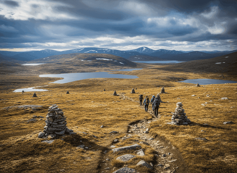
Long before modern roads, Vikings crossed the mountains of Setesdal using high plateaus and gentle passes that avoided the steepest terrain while connecting eastern and western Norway. This route near Valle follows terrain that allowed people on foot, pack animals carrying goods, and even small herds to move between eastern Norway's inland valleys and the western fjords where ships connected to the wider Viking world.
The Trail
Long before modern roads, Vikings crossed the mountains of Setesdal using high plateaus and gentle passes that avoided the steepest terrain while connecting eastern and western Norway. This route near Valle follows terrain that allowed people on foot, pack animals carrying goods, and even small herds to move between eastern Norway's inland valleys and the western fjords where ships connected to the wider Viking world. The mountain passes were crucial economic arteries—eastern valleys produced furs, inland fish, and timber; western fjords offered access to ocean fish, imported goods from abroad, and ship-building materials. Controlling these passes meant controlling trade and accumulating wealth. The landscape is open and quiet, dotted with small tarns and lakes that provided water for travelers and animals, and marked by stone cairns that served as navigation aids in fog or snow—some of these markers are ancient, placed by hands centuries ago to help others find the way.
What to Expect
The route crosses classic Norwegian highland terrain at 800-1000 meters elevation: rolling plateaus, exposed bedrock, scattered boulders left by glaciers, low vegetation adapted to harsh conditions. Walking here feels slow and deliberate—exactly how travel once was in a land where weather decided everything. A sudden storm could trap travelers for days, making knowledge of shelter locations critical. Snow could block passes from September through June, limiting the traveling season to brief summer months. The pace was measured in days, not hours, with overnight stops at known locations marked by stone shelters or natural features.
Planning Your Visit
Today, the route can be walked in sections of 4-6 hours, experiencing the landscape without the hardship. The high elevation provides expansive views over Setesdal valley and surrounding peaks. Stone markers and occasional shelter ruins connect you tangibly to those who traveled this route carrying goods, stories, and news between communities. The area is best visited July through September when snow has cleared. Navigation skills are valuable as the route is not always clearly marked. Weather can change rapidly on exposed plateaus—pack layers and rain gear. The combination of historical significance, beautiful mountain scenery, and genuine remoteness makes this special for hikers interested in Norway's cultural landscape and Viking-age communication networks.
Never get stuck for words in Norwegian
Someone speaks to you in Norwegian? TalkBuoy listens in real time and suggests exactly what to say back. Your AI companion for travel conversations and language learning.
Informasjon om tilknytning Denne siden inneholder tilknyttede lenker. Vi kan tjene en provisjon fra kjøp gjort gjennom disse lenkene.
Oppdag Agder / Telemark med lokale guider
Slipp planleggingsstresset! Bla gjennom tusenvis av verifiserte turer, aktiviteter og opplevelser. Fra nordlysekspedisjoner til fjordcruise - finn det perfekte eventyret.
Skjulte Norge deltar i tilknyttede markedsføringsprogrammer, inkludert GetYourGuide og andre. Dette betyr at vi kan tjene en provisjon når du bestiller turer eller kjøper gjennom våre tilknyttede lenker. Dette kommer uten ekstra kostnad for deg og hjelper oss med å fortsette å tilby gratis kvalitetsinnhold om Norges skjulte skatter. Vi anbefaler kun tjenester og opplevelser vi tror vil forbedre ditt norske eventyr.
Plassering
GPS-koordinater
59.2124, 7.5389