Hardangervidda Eastern Edge – Where Plateau Meets Forest
About This Adventure
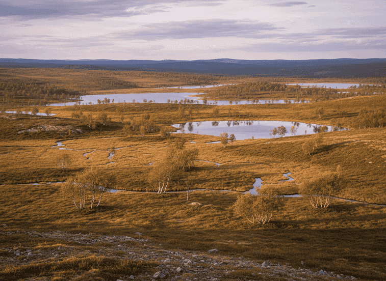
On the eastern edge of Hardangervidda, the high mountain plateau slowly descends into forested valleys, creating a transition zone rich in ecological diversity. This area sees far fewer visitors than the central plateau yet offers the same sense of scale and openness.
The Experience
On the eastern edge of Hardangervidda, the high mountain plateau slowly descends into forested valleys, creating a transition zone rich in ecological diversity. This area sees far fewer visitors than the central plateau yet offers the same sense of scale and openness. Walking here reveals how Norway’s largest mountain plateau connects to inhabited landscapes below. Reindeer migration routes pass through this zone, and tracks are often visible in soft ground. The terrain alternates between open moorland, low alpine vegetation, and scattered birch forest, providing shelter in changing weather.
Planning Your Visit
Small lakes and streams punctuate the route, making it easy to find rest points. The walking is generally gentle, though distances can feel long due to the openness. Summer brings wildflowers and long daylight; autumn adds rich colors and crisp air. Navigation skills are useful as trails can be faint. This route is ideal for hikers wanting the Hardangervidda experience without crowds or extreme exposure.
Never get stuck for words in Norwegian
Someone speaks to you in Norwegian? TalkBuoy listens in real time and suggests exactly what to say back. Your AI companion for travel conversations and language learning.
Affiliate Disclosure This page contains affiliate links. We may earn a commission from purchases made through these links.
Discover Vestland / Viken with Local Guides
Skip the planning stress! Browse thousands of verified tours, activities, and experiences. From Northern Lights expeditions to fjord cruises - find the perfect adventure.
Hidden Norway participates in affiliate marketing programs, including GetYourGuide and others. This means we may earn a commission when you book tours or make purchases through our affiliate links. This comes at no extra cost to you and helps us keep providing free, quality content about Norway's hidden gems. We only recommend services and experiences we genuinely believe will enhance your Norwegian adventure.
Location
GPS Coordinates
60.4301, 7.5802